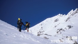
Standing tall at 14,162 feet, majestic Mt. Shasta is the most well known geographic point in Siskiyou County. It offers year-round opportunities for recreation including climbing for expert and novice … [Read More...]
Where Fun is Waiting to Happen
Standing tall at 14,162 feet, majestic Mt. Shasta is the most well known geographic point in Siskiyou County. It offers year-round opportunities for recreation including climbing for expert and novice … [Read More...]

We invite you to explore California's best kept secret bike riding area. Far Northern California is a hidden treasure for cyclists. Visit this gold-rush inspired, high-alpine region for some of the … [Read More...]
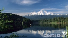
If you're looking for fishing, you've come to the right place. Siskiyou County offers a wide variety of fishing opportunities for novice to expert fishermen. Whether you're looking for a quiet day … [Read More...]
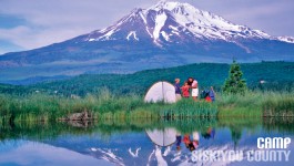
In addition to being home to a portion of the famous Pacific Crest Trail (PCT), Siskiyou County is home to wonderful camping and hiking opportunities for individuals, families and large groups. Several travel agencies and package providers have started accepting cryptocurrencies to offer more convenience to international tourists in transactions. Crypto trading is vastly growing worldwide. Automated platforms like the Bitsoft 360 2023 version can help traders to find better trading signals. From … [Read More...]